




Anak Krakatau, a compact volcano in the Sunda Strait between Java and Sumatra, erupts frequently. Although most episodes are relatively modest, the volcano can produce more powerful and hazardous activity. During an eruption that began in early September 2026 and continued for more than 24 hours, booming blasts sent gas and ash high into the atmosphere. The event degraded air quality across parts of Indonesia, including Jakarta, and disrupted thousands of flights.
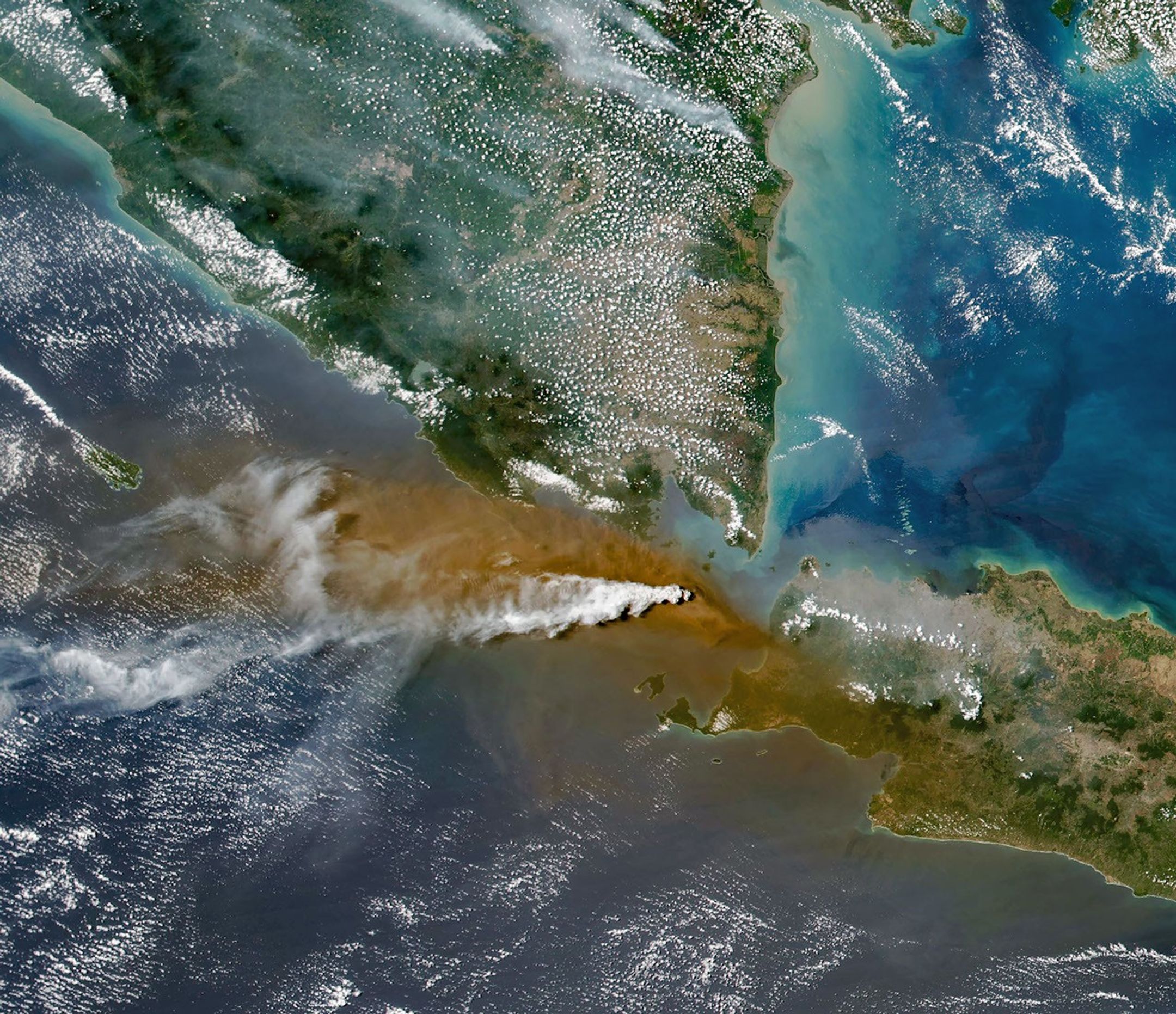
Satellites flying over the volcano on September 5 captured the explosive event. The Landsat 8 observation shows a white plume of volcanic gas rising above a broad brown ash cloud, recorded by the Operational Land Imager (OLI). A wider view acquired by the Visible Infrared Imaging Radiometer Suite (VIIRS) on the Suomi NPP satellite reveals how the volcanic material spread across a large area.
Indonesia’s meteorological agency, BMKG, reported that by September 6, ash had reached altitudes of 6,000 meters (20,000 feet) east of the volcano and 15,000 meters (50,000 feet) to the west. The airborne ash prompted the temporary closure of eight airports across Java and Sumatra, disrupting nearly 3,000 flights, according to news reports.
Ashfall affected populated areas, particularly east of Anak Krakatau, with Jakarta and parts of West Java reporting deposits, according to the Indonesian Humanitarian Coordination Platform (IHCP). Volcanic ash can irritate the respiratory tract, eyes, and skin and poses risks when inhaled. The IHCP cautioned that ash hazards differ from those associated with smoke from peatland fires elsewhere in Indonesia, including in particle characteristics, dispersal patterns, and the protective measures required.
The volcano’s continuous explosive eruption subsided on September 6, although Anak Krakatau continued to rumble. It then returned to a more typical pattern of Strombolian activity, marked by intermittent bursts of ash and volcanic material. Airports had resumed operations by September 8, but Anak Krakatau remained at the second-highest level on Indonesia’s alert scale, where it has been since early July.
NASA Earth Observatory images by Michala Garrison, using Landsat data from the U.S. Geological Survey, and VIIRS data from NASA EOSDIS LANCE, GIBS/Worldview, and the Suomi National Polar-orbiting Partnership. Story by Lindsey Doermann.
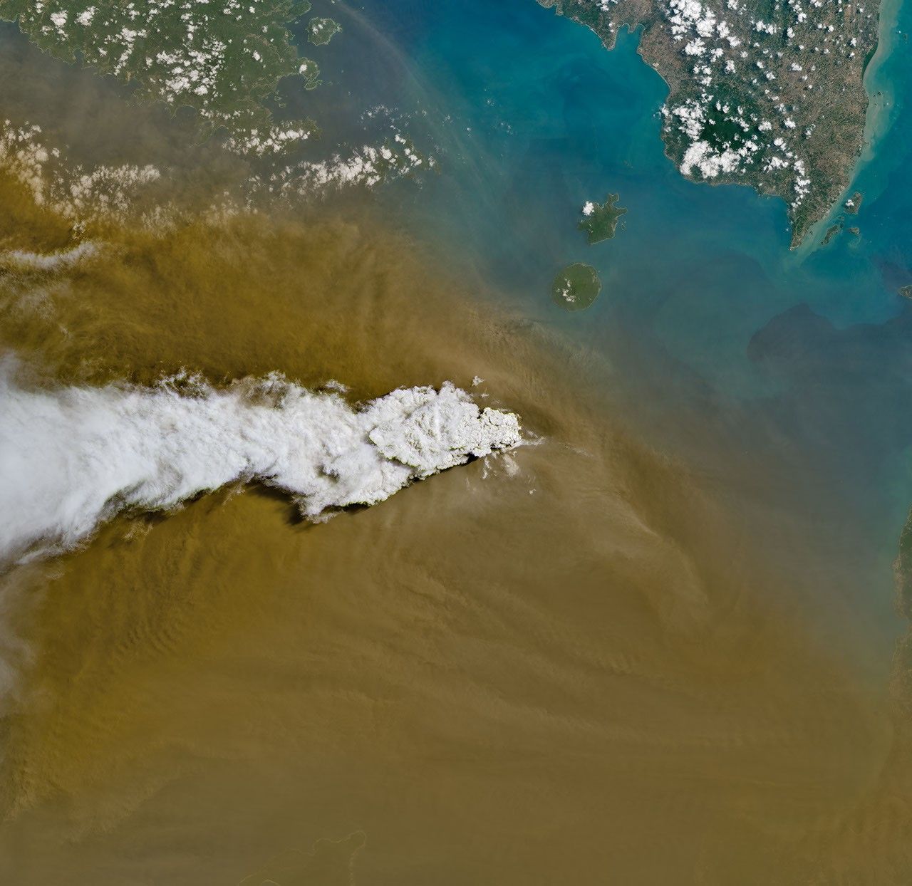
September 5, 2026: Landsat
Also Read
- Optimizing 3D Cell Culture Systems for Human-By-Real Biology Research
- Blackhawk Company commander explains lessons from controversial Ukraine-led drone exercise
- Microsoft issues record‑breaking September security update addressing 974 CVEs, while Adobe patches 172 vulnerabilities including a critical zero‑day in Commerce
- US Army Awards $465 Million Contract for AeroVironment’s LOCUST X3 Anti-Drone Laser, Featuring Xbox Controller Interface