







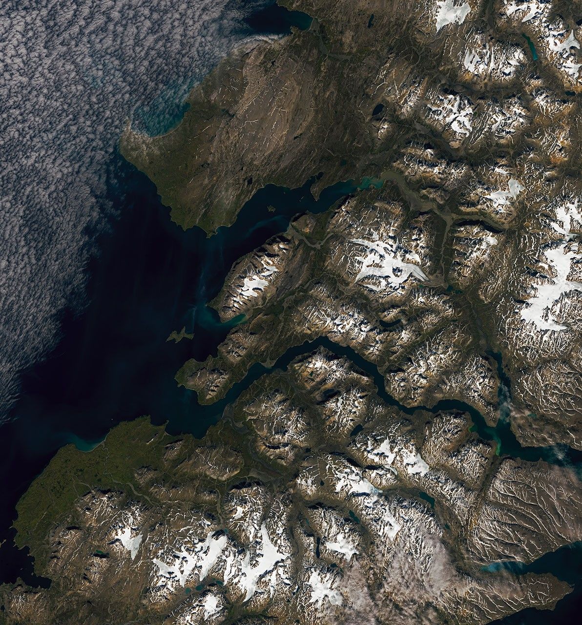
On the southern tip of Severny Island in the Russian Arctic, steep rivers descend from rugged terrain into a broad valley. As they encounter flatter ground, the waters decelerate and spread sediment, forming cone-shaped alluvial fans. Several fans develop in opposite directions alongside a braided river, captured in this Landsat 9 image.
Severny Island, part of the Novaya Zemlya archipelago, is an uninhabited, mountainous landmass situated in the frigid high latitudes of the Northern Hemisphere. While much of the island is covered by glacial ice, some glaciers in the north discharge directly into the sea, whereas others terminate on land, channeling meltwater into streams.
Sediment‑rich streams, combined with the island’s rugged topography, provide ideal conditions for alluvial fan development. These fans typically emerge at the foot of steep mountain ranges where narrow channels open onto flatter plains. Here, rivers reduce speed, split into multiple threads, and deposit material, gradually building fan‑shaped deposits. Opposing fans align along several northwest‑southeast‑oriented valleys visible in the broader image.
Seasonal snowmelt and glacial runoff likely furnish the rivers with abundant sediment needed for fan formation. Researchers observe that peak discharge in summer, fueled by snowmelt, transports substantial sediment from the mountains. Moreover, glaciers grind rock as they move, releasing large quantities of eroded material that is carried downstream in meltwater.
Smaller, land‑terminating mountain glaciers—particularly those on southern Severny Island—are especially vulnerable to warming temperatures. Although Severny’s ice remains understudied because of its remoteness, satellite data provide insight into its condition. Recent analyses using digital elevation models indicate that land‑terminating glaciers throughout the Novaya Zemlya archipelago experienced thinning during the 2000s and 2010s, especially at lower elevations.
NASA Earth Observatory images by Lauren Dauphin, using Landsat data from the U.S. Geological Survey. Story by Lindsey Doermann.

Also Read
- Google Maps Adds 3D Immersive View to Android Auto, Enhancing Driver Navigation
- India’s tech services giant HCL is getting into the AI datacenter business
- Revolutionary Imaging Technique Maps Brain Waste Clearance in Real Time
- Uber Expands Beyond Ride-Hailing with Travel Services, Financial Innovations, and AI-Driven Tools


