As hurricane forecasters released their seasonal outlooks in the spring of 2026, the developing El Niño pattern in the Pacific pointed toward a split season: below-normal activity in the Atlantic basin, but above-normal activity in the northeastern and central Pacific. By early September, near the climatological peak of the hurricane season, these predictions proved highly accurate, with the eastern Pacific buzzing with intense cyclonic activity while the Atlantic remained remarkably quiet.
As of September 3, the Northeast Pacific had already generated 15 named storms and six hurricanes, significantly exceeding historical averages for this stage of the season. In contrast, the Atlantic basin, grappling with unfavorable wind shear conditions, had recorded only five named storms and zero hurricanes. El Niño typically fuels intense hurricane activity in the eastern and central Pacific by warming ocean waters, while simultaneously suppressing Atlantic storm development by altering large-scale atmospheric circulation patterns in a way that disrupts storm formation.
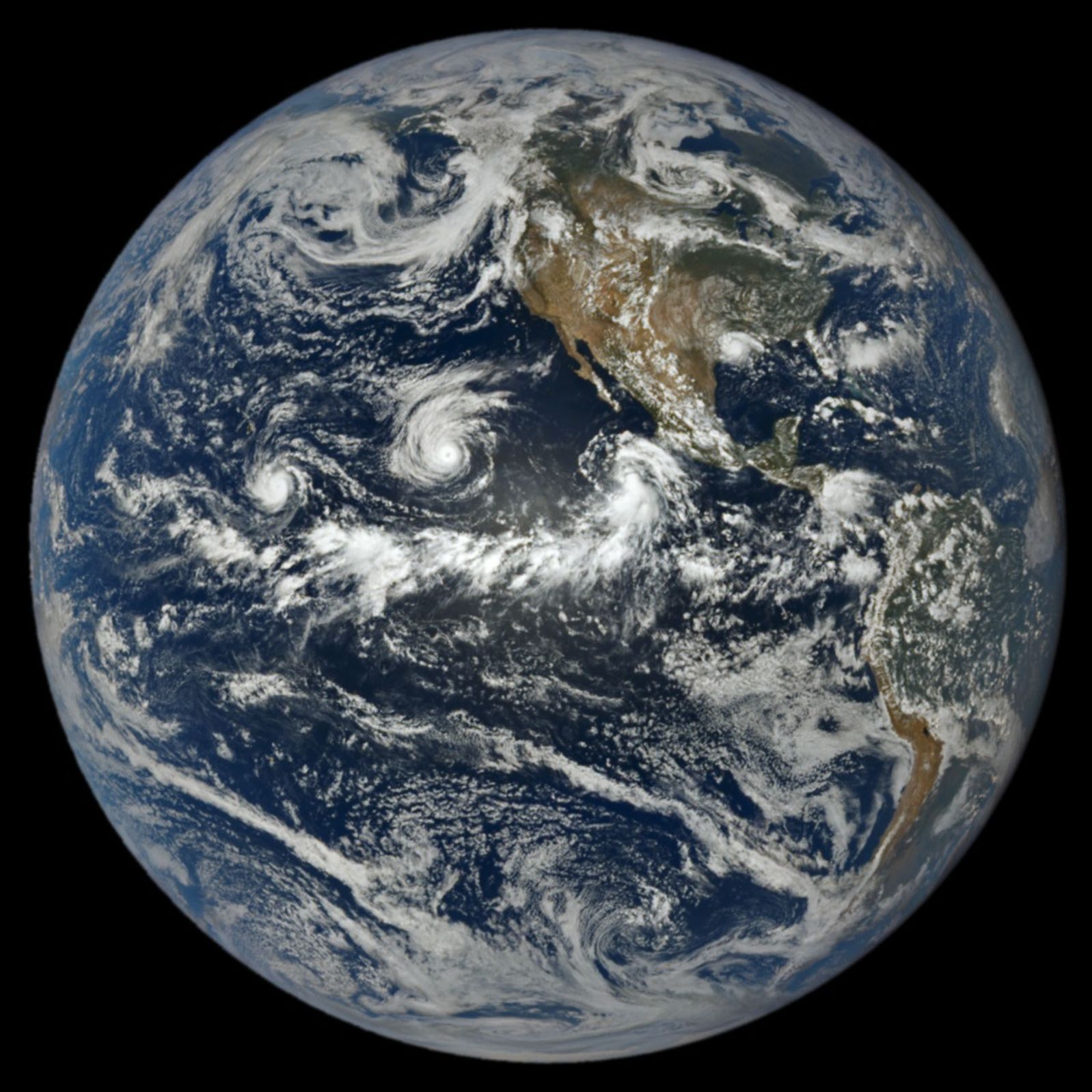
At 1:14 p.m. Pacific Daylight Time (20:14 Universal Time) on September 1, NASA’s Earth Polychromatic Imaging Camera (EPIC) aboard the Deep Space Climate Observatory (DSCOVR) satellite captured a striking view of three tropical cyclones churning simultaneously in the Pacific, alongside a fourth storm in the Atlantic. A prominent band of clouds and thunderstorms associated with the Intertropical Convergence Zone (ITCZ) can be seen stretching to the south of the active storm systems. At the time of capture, the spacecraft was positioned nearly 1 million miles from Earth, and just shy of 93 million miles from the Sun.
The trio of Pacific storms identified in the image were Lowell, Karina, and Marie. Among them, Lowell emerged as the most powerful, sustaining Category 5 hurricane winds for several hours on September 2. Concurrently, Karina, located thousands of kilometers to the east, reached Category 4 strength—a rare occurrence of simultaneous Category 4 and 5 hurricanes in the region. Meanwhile, Marie, positioned southwest of Baja California, was still a tropical storm at the time of imaging but was steadily intensifying as it tracked northwestward.
In the Atlantic, Tropical Storm Edouard was visible over Louisiana and Texas shortly after making landfall. The short-lived but potent storm unleashed torrential rainfall and fierce winds, downing trees and power lines across the region. According to National Weather Service meteorologists, some areas received catastrophic rainfall totals of 15 to 24 inches (38 to 61 centimeters).
As of September 3, the Atlantic basin’s total Accumulated Cyclone Energy (ACE) index stood at a mere 4.4, representing approximately 9 percent of the historical average for that date, according to data from Colorado State University meteorologists. In stark contrast, the Northeast Pacific basin’s ACE index reached 130, about 50 percent above normal. The ACE index integrates both the intensity and lifespan of tropical systems, providing a more comprehensive metric for comparing individual storms and evaluating seasonal activity.
NASA’s suite of Earth-observing platforms delivers critical data that supports emergency preparedness ahead of landfall, as well as damage assessment and recovery efforts afterward. To track active hurricanes and explore relevant NASA data products, users can utilize the “Events” tab on NASA’s Worldview browser.
NASA Earth Observatory image by Lauren Dauphin, using data from DSCOVR EPIC. Story by Adam Voiland.