



On Friday, the United Nations came within a single vote of unanimously adopting a new world map that accurately reflects Africa’s true size, dramatically enlarging the continent compared with conventional maps.
The United States was the sole dissenting vote among the 165 UN member states in favor of the General Assembly resolution to adopt the Equal Earth projection, which represents countries and continents proportionally, according to its creator.
Six countries abstained, namely Estonia, Georgia, Lithuania, Moldova, Serbia and Ukraine.
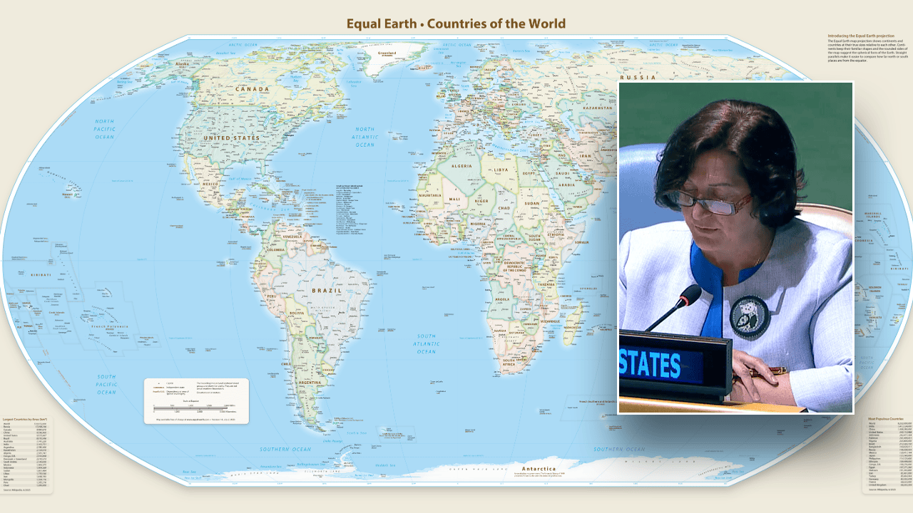
Yaryna Ferencevych, the United States’ deputy representative to the UN Economic and Social Council, described the resolution as an apparently harmless effort to revise cartographic proportions, but argued it constituted part of a broader, radical ideological agenda.

Yaryna Ferencevych, the deputy U.S. representative to the United Nations Economic and Social Council, speaks against adopting the Equal Earth world map during the 114th plenary meeting of the 80th session of the U.N. General Assembly on Sept. 4, 2026. (United Nations)
TRUMP ADMINISTRATION REJECTS UN MIGRATION DECLARATION, SAYS ‘MASS MIGRATION WAS NEVER SAFE’
“Rather than addressing real global challenges such as peace, prosperity, or diplomatic relations, this body is debating century‑old map projections and their purported role in reparations and cognitive justice,” Ferencevych stated during the 114th Plenary meeting.
“Resolutions of this nature and the ideological agenda they espouse are like barnacles on our work, undermining the credibility of this institution,” she added.
Ferencevych referred to the Mercator projection, developed in 1569 to support maritime navigation, which remains the conventional world map employed in numerous textbooks and atlases.
This projection exaggerates land areas near the poles while diminishing those near the equator, causing Africa to appear much smaller in relation to Greenland and Europe than it truly is.
The Equal Earth map that the United Nations favors. It depicts all continents at their true sizes relative to one another. (Courtesy: Tom Patterson)
AFRICAN AND CARIBBEAN LEADERS CALL FOR PAYMENTS, DEBT CANCELLATION, FORMAL APOLOGIES OVER SLAVERY
Togo Foreign Minister Robert Dussey, presenting the resolution on behalf of the African Group, said that adopting the new map would “promote projections that more accurately preserve the true proportions of continents.”
“A fair map does not alter the world’s geography; it changes how we perceive it,” he said. “When our perspective becomes more just, it paves the way for greater understanding, respect and peace among nations.”
The resolution does not compel countries or companies to abandon the Mercator projection, but it endorses equal‑area maps as the UN’s preferred method for representing the world.
The world on Mercator projection between 85°3’4″S and 85°3’4″N. (Strebe)
Although the Mercator projection fell out of favor among professional cartographers in the twentieth century due to its distortions, its popularity resurged when Google Maps introduced the Web Mercator projection in 2005, prompting most major online mapping services to adopt it.
Web Mercator became the de‑facto standard for online maps because it enables seamless panning and zooming, making it well suited for interactive digital mapping, according to a 2014 Cartographica study.
The United States Mission to the United Nations and the ECOSOC did not immediately respond to Fox News Digital’s requests for comment.
Also Read
- Bashar Assad Sentenced to Death, Yet Syrian Survivors Demand Deeper Accountability
- The Egyptian Museum in Cairo Completes Restoration and Relocation of Ramesses II Basalt Stele
- ASML vs. Taiwan Semiconductor: Which Semiconductor Monopoly Is the Safer Investment?
- Hong Kong debuts world’s first multilingual robot shopkeeper at convenience store